
Suoi Thau at a Glance
- Current location: Pà Vầy Sủ Commune, Tuyen Quang Province
- Historic travel region: Former Xin Man District, Ha Giang Province
- Common tourism name: Suoi Thau Ha Giang
- Elevation: More than 1,200 m (3,940 ft)
- Approximate plateau area: Nearly 100 hectares
- Distance from Pà Vầy Sủ center: Around 7 km
- Known for: Open plateau scenery, farmland and seasonal flowers
- Best for: Photography, couples, nature and slow travel
- Typical visit: Half day to one day
- Nearby bases: Pà Vầy Sủ/Cốc Pài area and Bac Ha
Current provincial tourism information describes Suoi Thau as a plateau of nearly 100 hectares on Gia Long Mountain, reached by a roughly 7 km mountain road from central Pà Vầy Sủ.
Unlike the limestone scenery of Dong Van and Ma Pi Leng Pass, Suoi Thau feels wide and open. It is best suited to travelers interested in photography, rural landscapes and slower mountain travel rather than a long list of attractions.
For most visitors, half a day to one full day is enough on the plateau. If you are coming from Hanoi, allow at least 2 days and 1 night, although 3 days is more comfortable.
Where Is Suoi Thau?
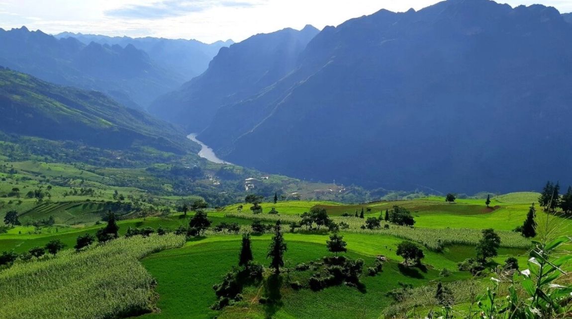
Suoi Thau lies in the western highlands of northern Vietnam, close to the former Xin Man area and the mountains connecting the region with Bac Ha in Lao Cai.
Older travel guides place Suoi Thau in Xin Man District, Ha Giang Province. That was correct before Vietnam's 2025 administrative changes. Today, Suoi Thau belongs to Pà Vầy Sủ Commune, Tuyen Quang Province.
For travelers, the administrative change does not significantly alter the route. “Suoi Thau Ha Giang” remains the most recognizable travel name and is still useful when searching for older maps, accommodation and regional guides.
Why Is Suoi Thau Called the “Mini Switzerland”?
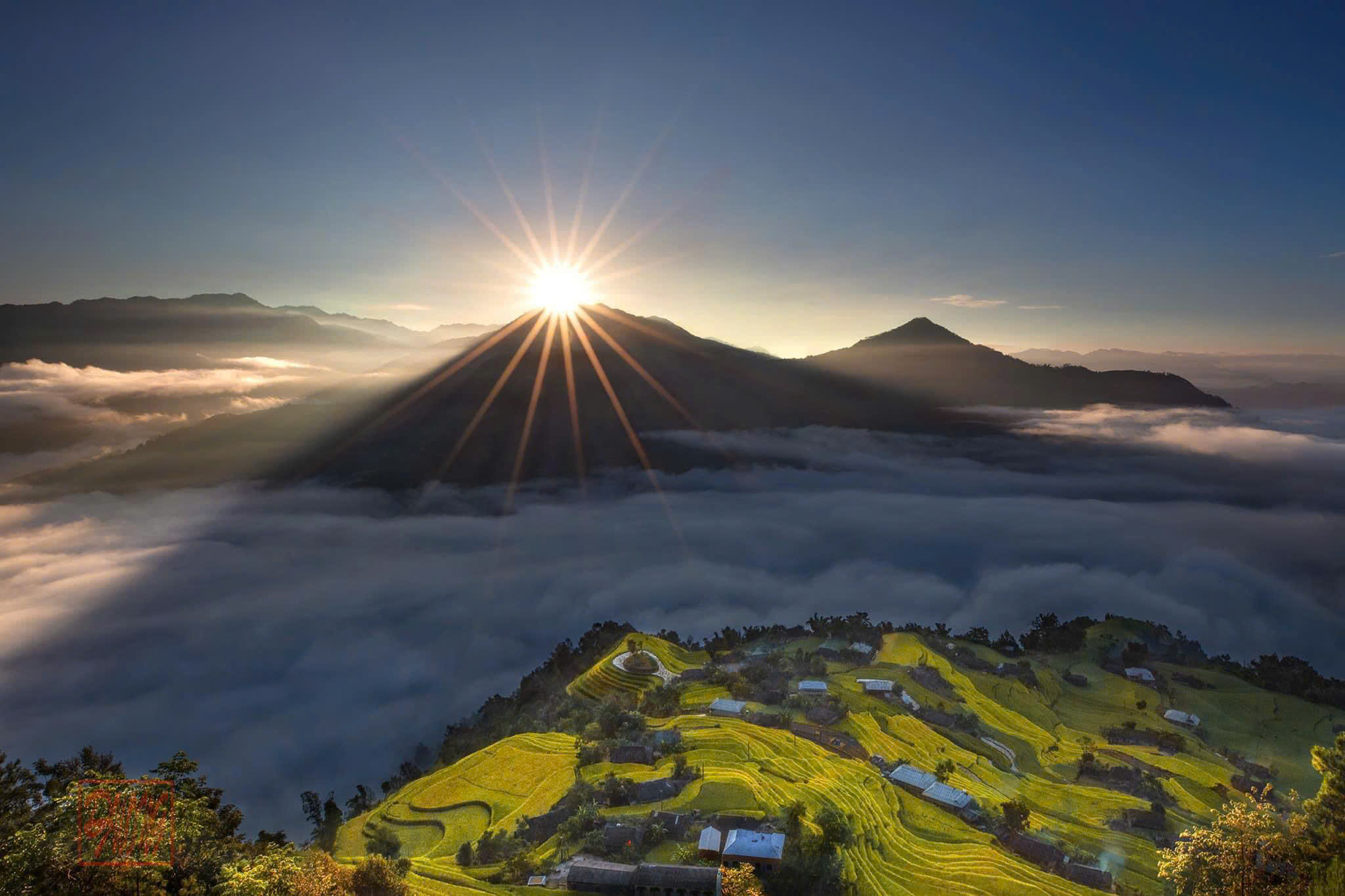
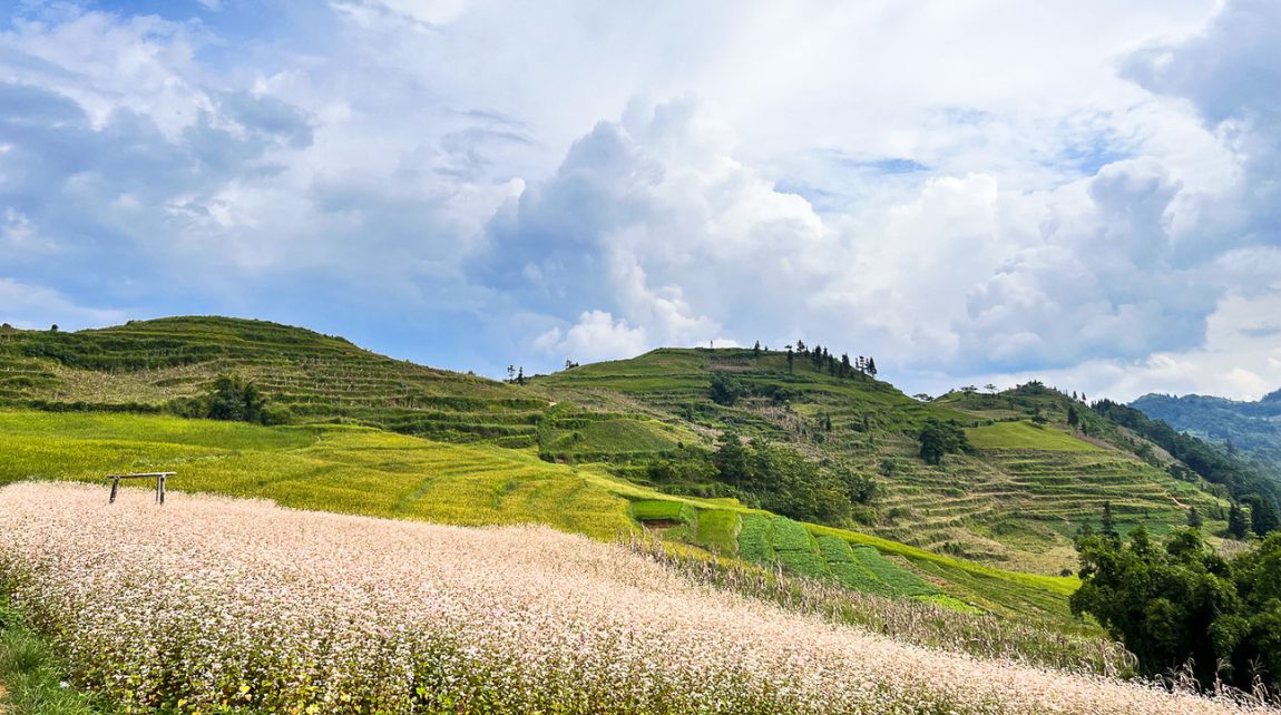
Suoi Thau is frequently nicknamed the “mini Switzerland” of northern Vietnam because its broad grassland, cultivated fields, cool highland climate and distant mountain ridges look very different from the rocky landscapes most travelers associate with Ha Giang.
Suoi Thau remains a working agricultural landscape shaped by local communities rather than a European-style resort destination. That is an important part of its appeal.
What Makes Suoi Thau Worth Visiting?
Suoi Thau is worth visiting if you prefer landscape and atmosphere over conventional sightseeing.
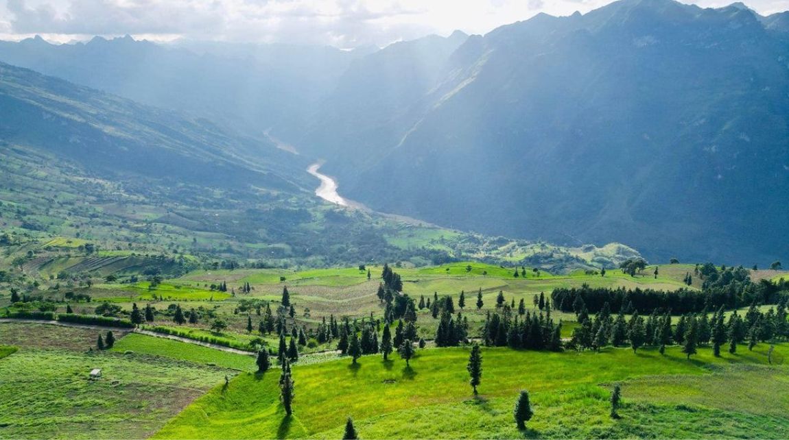
The plateau combines:
- Open grassland
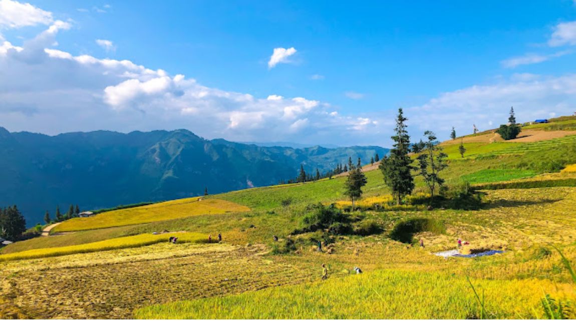
- Corn and rice fields
- Seasonal flower gardens
- Fruit trees
- Mountain ridges
- Rural homes
- Mist and cloud during changing weather
Its biggest strength is the sense of space.
Instead of stopping at one viewpoint for a few photographs, travelers can spend time walking, observing agricultural life and watching the landscape change with the light and weather.
Best Time to Visit Suoi Thau
September to November is one of the strongest periods for photography, but there is no single best season for everyone. Suoi Thau changes noticeably through the year, and flower conditions depend on farming schedules and weather rather than fixed annual dates.
Spring: March to April
Spring brings fresh vegetation and cooler conditions.
Mustard flowers and other seasonal crops may add color to the plateau, depending on that year's planting schedule.
Spring works well for:
- Walking
- Rural photography
- Cooler mountain weather
- Travelers who prefer fewer harvest-season visitors
Summer: May to August
Summer brings some of Suoi Thau's greenest landscapes.
Rice, corn, grassland and other crops dominate the plateau. Tourism authorities have also documented seasonal sunflower cultivation as an additional tourism activity, although travelers should not assume sunflower fields appear in exactly the same place or period every year.
The trade-off is rain. Mountain roads may become more difficult after prolonged rainfall, so check conditions locally before departure.
Autumn: September to November
Autumn is one of the most photogenic periods at Suoi Thau. Depending on local cultivation, visitors may see:
- Ripening or harvested crops
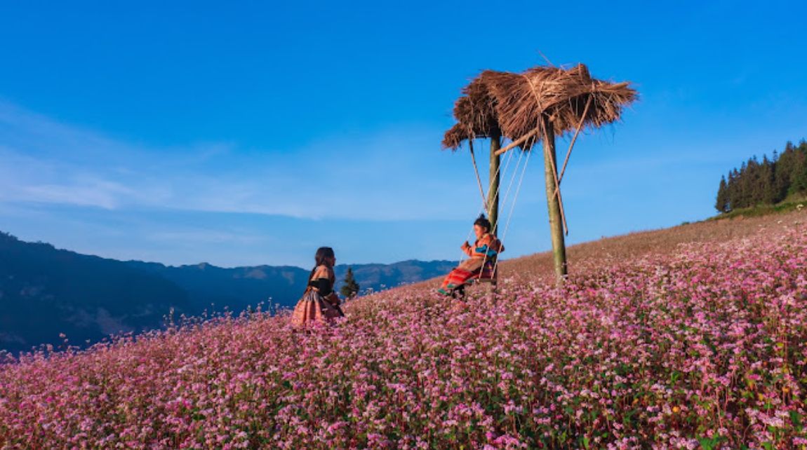
- Buckwheat flowers
- Green and golden fields
- Clearer mountain views
- Morning mist
Current tourism information continues to identify buckwheat, corn, rice and seasonal flowers as important parts of the area's agricultural landscape.
If buckwheat flowers are your main reason for visiting, check recent local photographs before traveling. Peak bloom changes every year.
Winter: December to February
Winter is quieter, colder and often more atmospheric.
Fog and cloud can reduce visibility, but they can also create dramatic photography conditions.
Bring warm layers. At more than 1,200 meters, mornings and evenings can feel considerably colder than Hanoi or Vietnam's lowlands.
Things to Do in Suoi Thau
1. Walk Across the Plateau
Walking is the simplest and best way to experience Suoi Thau.
The plateau is not built around a fixed attraction circuit. Take time to explore permitted paths and viewpoints rather than staying only beside the road.
Because much of the land is actively cultivated:
- Stay on established paths
- Do not walk through crops
- Ask before entering private fields
- Avoid disturbing livestock
- Take all rubbish with you
2. Photograph the Seasonal Landscape
Suoi Thau is especially suited to landscape photography.
Depending on the season, subjects may include:
- Buckwheat flowers
- Mustard flowers
- Rice and corn fields
- Grassland
- Fruit trees
- Mountain ridges
- Traditional rural houses
Early morning and late afternoon generally provide softer light, but weather matters more than a fixed photography schedule.
A cloudy morning can become clear later in the day, so allow some flexibility.
3. Experience the Agricultural Landscape
Suoi Thau is home primarily to Hmong communities whose farming activities shape much of the plateau's appearance.
Current provincial information notes cultivation of rice, corn, medicinal plants and seasonal flowers. For visitors, the important point is that this is a living agricultural community, not an outdoor photo set.
Ask before photographing residents at close range, particularly children, and do not enter homes or farmland without permission.
4. Watch the Light Change Across the Mountains
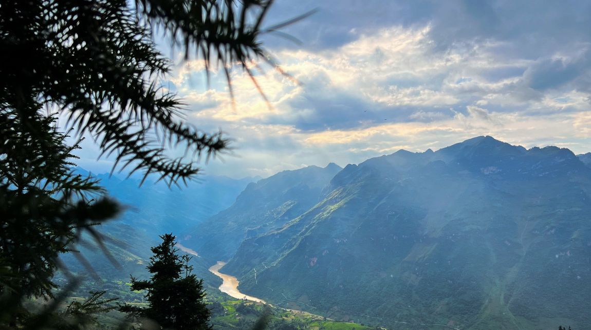
Because Suoi Thau is elevated and relatively open, sunrise and late afternoon can be particularly attractive.
You may see:
- Mist settling between ridges
- Clouds moving across the plateau
- Long shadows over the fields
- Warmer late-afternoon light
If sunrise photography matters to you, staying nearby is more practical than attempting a long mountain journey before daylight.
How to Get to Suoi Thau Ha Giang?
The easiest approach depends on whether you are coming from Hanoi, Bac Ha or the western Ha Giang region.
Current provincial guidance identifies a road route from Hanoi via the Hanoi - Lao Cai Expressway, Bao Thang and Bac Ha before continuing toward Suoi Thau. Another approach reaches the area from Tuyen Quang through the northern mountain road network.
From Bac Ha
Bac Ha is a practical base for travelers approaching from Lao Cai.
Combining Bac Ha + Suoi Thau makes sense because it reduces the need to return through central Ha Giang simply to reach the plateau.
This route works particularly well for travelers already visiting northern Lao Cai.
From Western Ha Giang
Travelers exploring Hoang Su Phi or the former Xin Man region can incorporate Suoi Thau into a longer western mountain itinerary.
Do not judge travel time only by distance. Roads include steep sections, repeated bends and possible roadworks.
By Motorbike
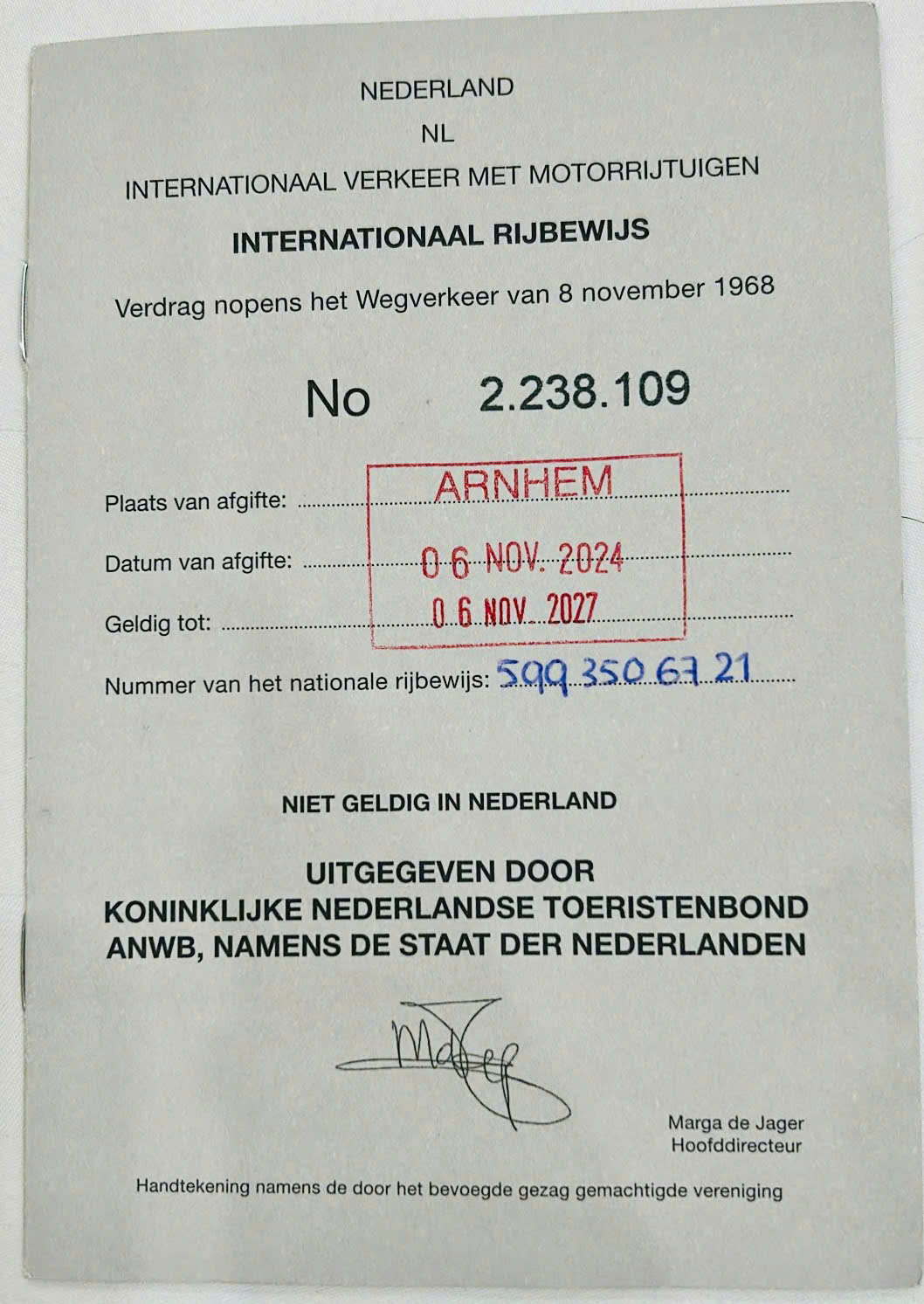
A motorbike offers the most flexibility but is best suited to travelers who already have strong mountain-riding experience and the correct documents for riding legally in Vietnam.
Do not use remote mountain roads as a place to learn.
By Private Car
A private car is better suited to:
- Families
- Couples prioritizing comfort
- Small groups
- Travelers carrying more luggage
- Visitors who do not want to ride
An enclosed vehicle also provides more protection from rain and cold.
With a Local Driver
A local driver is a practical option if you want flexibility without navigating unfamiliar mountain roads yourself.
Local road knowledge becomes particularly valuable after heavy rain or during periods of road construction.
Is Suoi Thau Part of the Ha Giang Loop?
No. Suoi Thau is not part of the classic Ha Giang Loop through Quan Ba, Yen Minh, Dong Van, Ma Pi Leng Pass and Meo Vac.
This distinction is important when planning your itinerary.
Suoi Thau lies much farther west and works better as:
- A western highlands trip
- An extension from Hoang Su Phi
- A journey combined with Bac Ha
- A separate trip for photographers and slow travelers
Trying to squeeze Suoi Thau into a standard 3-day Ha Giang Loop would create unnecessary driving.
If this is your first trip and you only have three or four days, the classic Loop will usually provide a more logical itinerary.
If you have additional time or have already completed the Loop, Suoi Thau offers a very different landscape.
For western Ha Giang planning, HaGiangGo's Hoang Su Phi travel guide can help you understand how the terrace region fits into a longer northern itinerary.
Where Should You Stay Near Suoi Thau?
Do not rely on finding a wide choice of accommodation directly on the plateau. Tourism infrastructure around Suoi Thau is developing, but services remain much more limited than in established destinations such as Dong Van or Sapa.
For most international travelers, practical bases include:
Pà Vầy Sủ / Cốc Pài Area
Best if Suoi Thau is your main priority.
Staying nearby makes it easier to:
- Reach the plateau early
- Wait for weather to improve
- Avoid a long return journey after sunset
Bac Ha
Best if you are combining Suoi Thau with northern Lao Cai. Bac Ha has a more established selection of accommodation and food services and can be incorporated into the Hanoi–Lao Cai approach.
Hoang Su Phi Area
Best if Suoi Thau is part of a longer trip focused on western mountain scenery, rice terraces and trekking.
What Should You Bring?
Suoi Thau is relatively simple to visit, but the remote mountain setting means you should arrive prepared.
Bring:
- Light rain jacket
- Warm layer
- Comfortable walking shoes
- Drinking water
- Snacks
- Sunscreen
- Hat
- Power bank
- Offline map
- Cash in Vietnamese dong
- Waterproof protection for electronics
- Personal medication
Mountain weather can change quickly, so layers are more useful than one heavy piece of clothing.
Suoi Thau vs. Other Northern Destinations
Suoi Thau
- Landscape: Open plateau, farmland and seasonal flowers
- Best for: Photography and slow travel
- Atmosphere: Quiet and rural
Hoang Su Phi
- Landscape: Extensive terraced rice fields
- Best for: Trekking, rice photography and multi-day rural travel
- Atmosphere: Remote and agricultural
HaGiangGo's current trekking guidance recommends allowing several days for Hoang Su Phi rather than treating it as a short extension of the classic Loop.
Dong Van Karst Plateau
- Landscape: Limestone karst
- Best for: First-time Ha Giang travelers and the classic Loop
- Atmosphere: More established for tourism
Ma Pi Leng Pass
- Landscape: High mountain pass and canyon
- Best for: Panoramic viewpoints
- Atmosphere: Dramatic and exposed
Bac Ha
- Landscape: Mountain valleys and agricultural areas
- Best for: Markets, regional culture and combining with Suoi Thau
- Atmosphere: More developed as a travel base
Who Should Visit Suoi Thau?
Suoi Thau is particularly well suited to:
- Landscape photographers
- Couples
- Slow travelers
- Nature-focused visitors
- Travelers exploring Bac Ha
- Visitors extending a Hoang Su Phi trip
- Experienced motorbike travelers
- Families using a private vehicle
It may be less suitable if you want:
- Nightlife
- Luxury resorts
- Many restaurants
- A dense list of attractions
- A short side trip from the classic Ha Giang Loop
Knowing this before you travel helps set the right expectations.
Is Suoi Thau Worth Visiting?
Yes, if you enjoy landscapes more than attractions.
Suoi Thau's appeal comes from its altitude, open space, working farmland, seasonal colors and views across the western mountains. It offers a completely different visual experience from the limestone roads around Dong Van and Meo Vac.
The main trade-off is location.
Suoi Thau requires extra travel time and works best when combined with Bac Ha, Hoang Su Phi or a broader western highlands itinerary rather than squeezed into the classic Ha Giang Loop.
If you have enough time, that extra journey is part of what makes the plateau rewarding.
Frequently Asked Questions About Suoi Thau
1. Where is Suoi Thau?
Suoi Thau is currently located in Pà Vầy Sủ Commune, Tuyen Quang Province. Before Vietnam's 2025 administrative reorganization, the area belonged to the former Xin Man region of Ha Giang, which is why “Suoi Thau Ha Giang” remains the common travel name.
2. How high is Suoi Thau?
The plateau sits at more than 1,200 meters (3,940 ft) above sea level and covers approximately 100 hectares on Gia Long Mountain.
3. What is the best time to visit Suoi Thau?
September to November is particularly attractive for autumn scenery and seasonal flowers. Spring offers fresh vegetation, while summer is greener but wetter. Flowering periods vary with local planting schedules and weather.
4. Can I see buckwheat flowers at Suoi Thau?
Yes, buckwheat is one of the seasonal crops grown around Suoi Thau, particularly in autumn. However, peak flowering dates vary each year, so check recent local conditions before traveling.
5. Is Suoi Thau on the Ha Giang Loop?
No. Suoi Thau is west of the classic Ha Giang Loop and is better combined with Bac Ha, Hoang Su Phi or another western highlands route.
6. How long should I spend at Suoi Thau?
Half a day is enough for a basic visit. A full day is better if photography is important. Travelers coming from Hanoi should generally allow at least two days for the overall journey.
7. Can I stay on Suoi Thau Plateau?
Visitor facilities directly on the plateau remain limited compared with established tourism towns. It is safer to plan accommodation in the wider Pà Vầy Sủ/Cốc Pài area, Bac Ha or another nearby destination rather than assuming a room will be available on arrival.
8. Can beginners ride a motorbike to Suoi Thau?
The route is not a good place to learn mountain riding. Roads include curves and elevation changes, and conditions can worsen after rain. Travelers without appropriate experience should consider a local driver or private vehicle instead.
Summary
Suoi Thau is most rewarding when it is treated as a destination in its own right, not another box to tick on the Ha Giang Loop.
Stay nearby if possible, check recent weather and flower conditions, allow enough time for the mountain roads and avoid building your trip around one exact bloom date.
For travelers already exploring western northern Vietnam, the strongest combinations are:
- Suoi Thau + Bac Ha
- Suoi Thau + Hoang Su Phi
- Suoi Thau + a longer western highlands journey
If your priority is the classic Ha Giang Loop, focus first on Quan Ba, Dong Van, Ma Pi Leng and Meo Vac. If you have more time and want a quieter landscape with fewer conventional attractions, Suoi Thau adds a very different side of northern Vietnam to the trip.