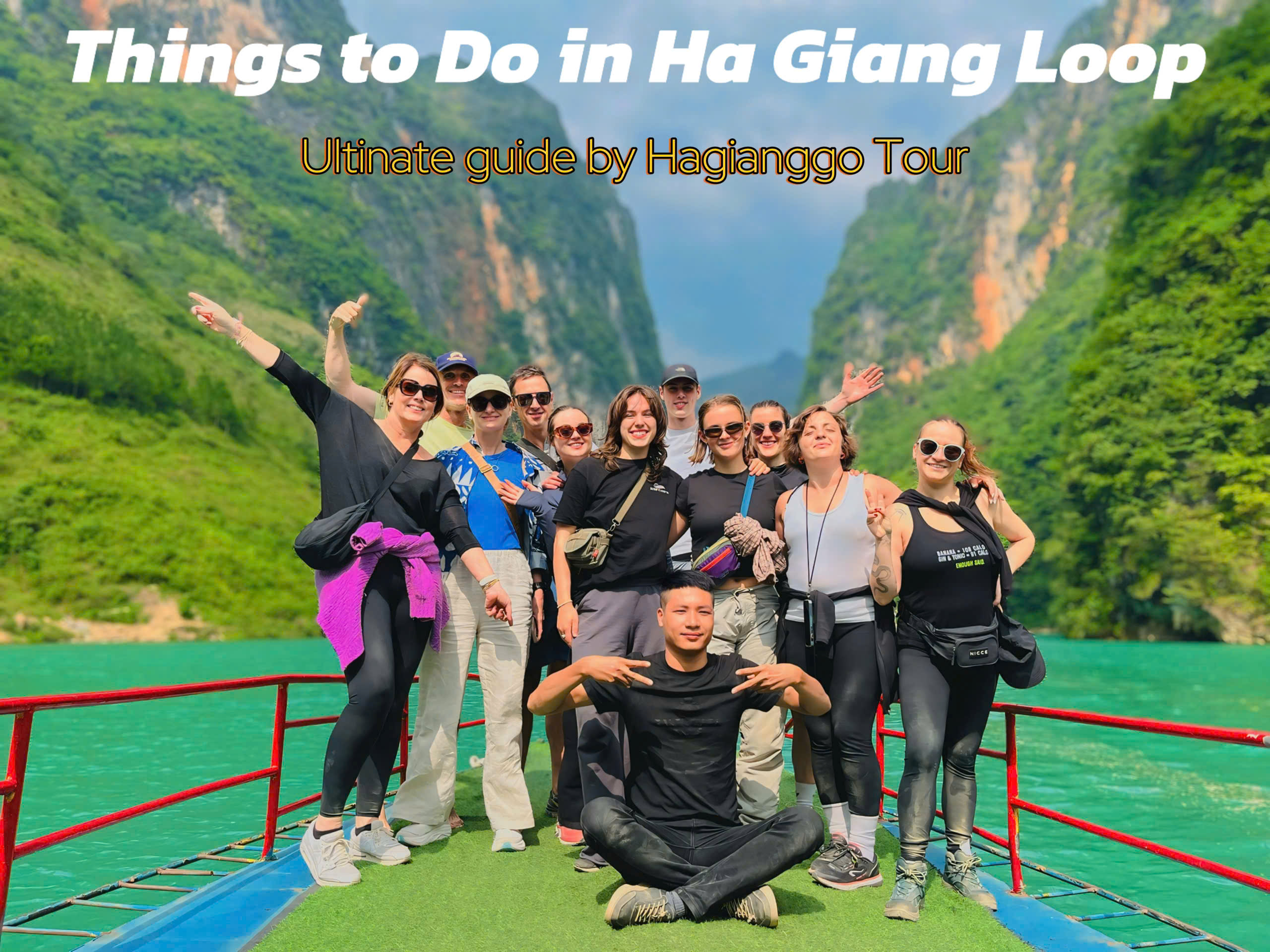
Nestled in the remote northern reaches of Vietnam, the Ha Giang Loop is a legendary motorbike route that winds through towering karst mountains, misty valleys, and traditional ethnic minority villages. But among the jaw-dropping scenery and adrenaline-pumping roads, one experience stands out as a must-do for thrill-seekers and nature lovers alike: the Skywalk Ha Giang Loop, perched along the dramatic Ma Pi Leng Pass.
This high-altitude trek, clinging to the edge of Vietnam’s most iconic pass, offers unparalleled views of the Nho Que River and Tu San Canyon. Whether you're an avid adventurer or a travel photographer in search of Vietnam’s best panoramic vistas, the Skywalk promises an unforgettable journey through some of the country's most untouched landscapes.
What is the Skywalk on the Ha Giang Loop?
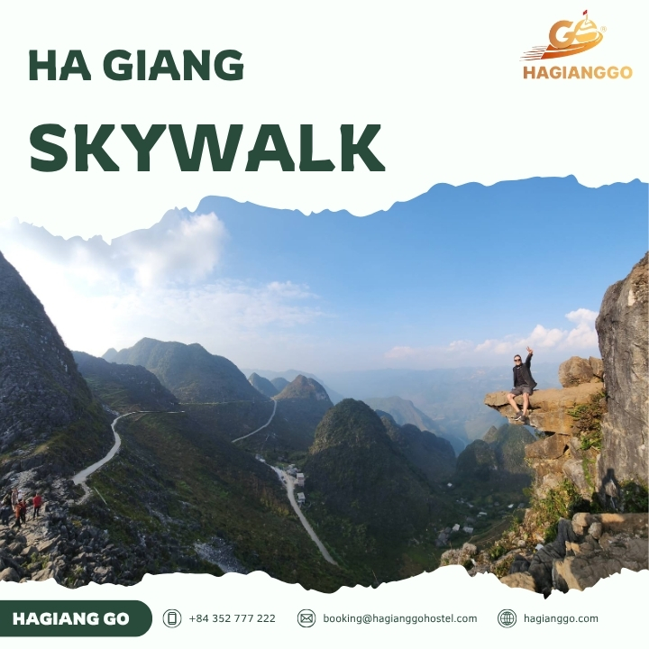
The Skywalk is a narrow, rugged hiking trail carved into the limestone cliffs of Ma Pi Leng Pass - often described as one of the most beautiful and dangerous roads in Vietnam. Unlike modern skywalks built with glass floors and safety railings, this one is raw, natural, and totally exposed to the elements. It’s a pathway suspended above deep gorges, sometimes just a meter wide, with nothing separating you from the 800-meter plunge below but your sense of balance.
The trail was originally used by local H’mong people and has recently gained popularity among adventurous travelers. It combines stunning geological formations with a thrill factor that few hikes in Southeast Asia can match. Along the way, you’ll pass cliffside shrines, secret viewpoints, and grazing goats, all set against a backdrop of cloud-wreathed peaks.
Where is the Ha Giang skywalk located?
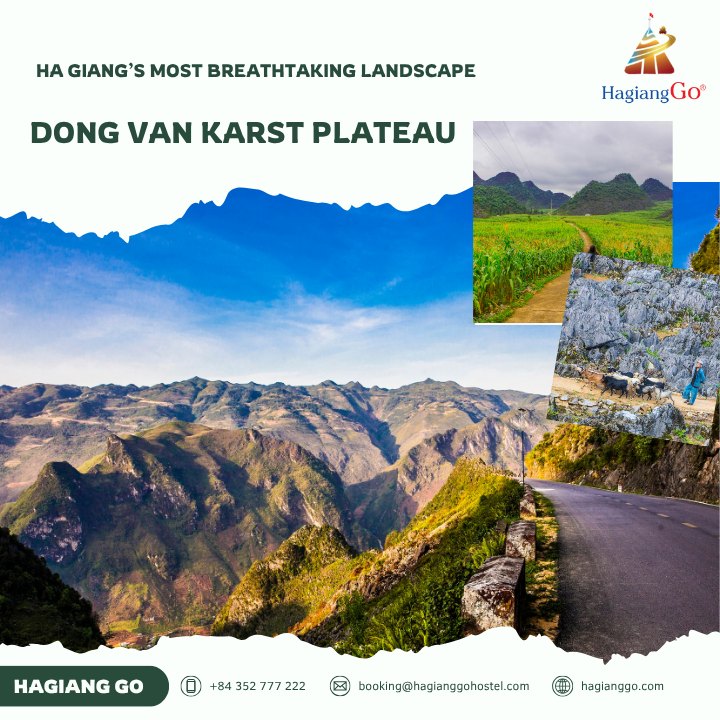
The Skywalk is located in Ma Pi Leng Pass, a section of the Ha Giang Loop that connects Dong Van and Meo Vac. This pass is part of the Dong Van Karst Plateau Geopark, recognized by UNESCO for its geological and cultural significance.
You’ll find the Skywalk near a famous viewing point often called the "Panorama" or "Ma Pi Leng Viewpoint." From here, a barely-marked trail veers off the side of the cliff. This is the entrance to the Skywalk. Though there are no official signs, many local guides and travel agencies (like Jasmine Tours and Trekking Tour Sapa) can point you in the right direction or lead you safely through the hike.
If you're starting in Ha Giang City, it takes roughly 6-7 hours by motorbike to reach Ma Pi Leng Pass. It’s best to spend the night in Dong Van or Meo Vac before tackling the trail.
Dong Van Old Town in Ha Giang: A timeless gem in Northern Vietnam
What to expect on the Ha Giang skywalk trail
Terrain and Difficulty
The trail is rugged, unpaved, and often just a foot or two wide. Some sections involve scrambling over rocks or maneuvering along slippery slopes. The exposure can be intimidating, and there are no guardrails, so a steady footing and respect for heights are essential.
Expect to spend 1.5 to 2 hours completing the full out-and-back route, depending on your pace and how often you stop to take photos (which, trust us, will be often).
Amazing experiences
As you walk along the trail, you’ll be treated to continuously changing angles of the deep turquoise Nho Que River and the jagged cliffs of Tu San Canyon. The silence, broken only by birds and the occasional breeze, is otherworldly. In many parts, you'll feel like you're floating above the clouds.
The rawness of the trail is part of its appeal. It’s not manicured or touristy; it’s wild and untamed. You might encounter local goats or farmers, but rarely more than a few other hikers.
Discover Dong Van Karst Plateau - Ha Giang’s most breathtaking landscape
Safety tips for skywalk in Ha Giang
Because the Skywalk is not an officially maintained path, safety is a real concern. Here are some essential tips to stay safe:
- Don’t hike alone: It’s best to go with a local guide or group.
- Proper footwear: Wear trail shoes or hiking boots with strong grip.
- Check the weather: Avoid hiking if it’s raining or foggy. The rocks become dangerously slippery.
- Start early: Begin your hike in the morning to avoid losing daylight.
- Hydrate: Bring water, as there are no shops or facilities on the trail.
- Don’t overestimate your abilities: If you have vertigo or are afraid of heights, this may not be for you.
Best time for having a Ha Giang skywalk tour
To get the most out of your Skywalk experience, timing is everything. The best periods to visit are:
- September to November: Cool, dry weather and clear skies make for perfect hiking conditions.
- March to May: Flowers bloom across the mountains, adding vibrant color to the already spectacular views.
Avoid the rainy season (June to August), when heavy showers can make the trail too dangerous.
Highlights and the most breataking scenic viewpoints
The Ha Giang Skywalk isn’t just a trail - it’s a feast for the senses and a jaw-dropping showcase of Vietnam’s raw natural beauty. As you make your way along this narrow mountain path, each twist and turn reveals a new panorama that feels straight out of a dream. Here are some of the unforgettable spots and experiences you’ll encounter:
Nho Que River - The Emerald Ribbon Below
From high above, the Nho Que River glistens like a ribbon of jade, slicing through rugged limestone mountains. Its surreal green color changes subtly throughout the day depending on the light - from misty turquoise in the morning to deep emerald in the golden hour. The contrast between the river and the surrounding dark cliffs is simply mesmerizing. It’s the kind of view that forces you to stop, breathe deeply, and just stare.
Tu San Canyon - Vietnam’s Grandest Chasm
Prepare to be humbled. Tu San Canyon, the deepest in Vietnam, is a geological marvel with cliffs that plunge over 800 meters down to the riverbed. Viewed from the Skywalk, it looks like the earth itself cracked open. It’s hard to believe such epic scale exists without crowds. The silence here is thunderous - broken only by wind and the distant echo of the river far below.
Sky-Edge Photo Spots - Not for the Faint of Heart
There are several natural ledges and rocky outcrops that jut out just enough to give you the feeling of walking on air. These Instagram-famous sky-edge spots offer the perfect backdrop: mountain ridges rolling into infinity, fog curling over peaks, and the abyss beneath your feet. Whether you’re posing dramatically or just soaking it in, safety is non-negotiable - these views are wild and unforgiving.
Drone-Friendly Views - Aerial Magic
For those with a drone, the Ha Giang Skywalk is a goldmine. The sharp ridges, winding trails, and dizzying drop-offs create an epic landscape from the sky. Many travelers use aerial shots to capture the scale and depth of Tu San Canyon or to follow the flow of Nho Que River. Tip: Be mindful of weather conditions and local rules - this area deserves respectful flying.
Some hikers even bring drones to capture aerial views - just be sure to fly responsibly.
How to get there?
Most travelers reach the Skywalk as part of the Ha Giang Loop, a motorbike circuit that can be done independently or with a guided tour. Here’s how to get started:
- From Hanoi to Ha Giang: Take a sleeper bus (6-8 hours) or hire a private car.
- Motorbike from Ha Giang City: Rent from a local shop. Check brakes and tires thoroughly.
- Join a tour: Many agencies offer 3-5 day Ha Giang Loop tours with the Skywalk as a featured stop.
Once you reach Ma Pi Leng Pass, ask your guide or a local for directions to the Skywalk trailhead.
For the most memorable and convenient experience, come with HagiangGo.
Skywalk etiquette and environmental responsibility
As this trail grows in popularity, it’s crucial to preserve its natural beauty:
- Leave no trace: Take all your trash with you.
- Stay on the trail: Avoid damaging surrounding flora.
- Respect locals: If you pass farmers or locals, a friendly nod or greeting goes a long way.
- Support local businesses: Book tours with ethical operators and buy from village vendors.
FAQs about the Skywalk Ha Giang Loop
1. Is the Skywalk dangerous?
→ It can be, especially in poor weather. But with caution and proper preparation, it’s manageable for experienced hikers.
2. Can beginners do the Skywalk?
→ It's not ideal for beginners unless accompanied by a guide. It requires balance, stamina, and confidence at heights.
3. Is it part of every Ha Giang Loop tour?
→ No, only some tours include it. Check in advance or request it as an add-on.
4. Are there any safety measures in place?
→ No railings or signs. You are hiking at your own risk.
5. Can I camp overnight?
→ Not recommended, due to exposure and lack of flat, safe spots.
6. Do I Need a Permit?
→ Yes. You need a travel permit to visit Ha Giang, especially areas within the Dong Van Karst Plateau. These can be arranged at police stations or through your accommodation in Ha Giang City.
Final thoughts: Is the Skywalk worth It?
Absolutely. The Skywalk on the Ha Giang Loop is one of Vietnam’s most unique and awe-inspiring experiences. It offers a rare chance to walk quite literally on the edge of the world, surrounded by towering cliffs and surreal natural beauty. It’s not for the faint of heart, but for those willing to take the path less traveled, the reward is unparalleled.
So lace up your boots, steel your nerves, and step out onto the Skywalk — Vietnam’s most thrilling mountain walk awaits.